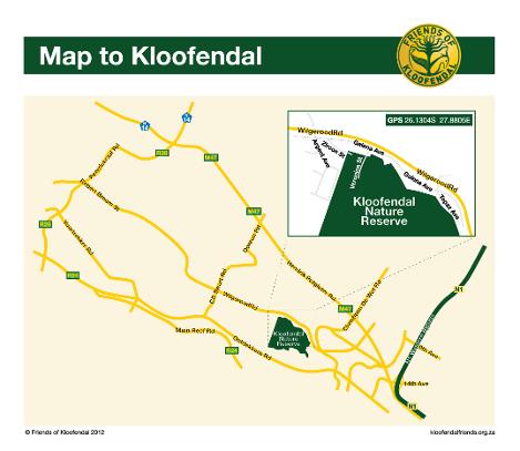
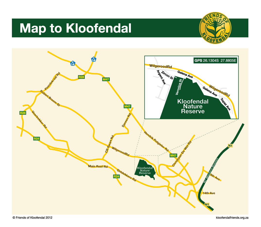
Map of the walking / hiking trails 

Where is the Kloofendal Nature Reserve? 

Download maps

Colour for the trails have changed in accordance with trail markers.

Map_to_Kloofendal-01.jpg Map_to_Kloofendal-01.jpg
Size : 371.029 Kb
Type : jpg
Knd_Trails.jpg Knd_Trails.jpg
Size : 532.226 Kb
Type : jpg

Google map 

How to get there? 

Via the N1 from the North or South: Turn off at 14th Avenue and turn West (away from Northcliff).  Pass underneath the Hendrik Potgieter bridges and turn right into Hendrik Potgieter.  Travel through several traffic lights and turn left into Christiaan de Wet drive (before the Clearwater Mall).  Travel along Christiaan de Wet Road up Struben's valley and turn right at Wilgerood Road.


(*) Turn left into Topaz Road at the second traffic light.  Almost immediately you meet a stop street at Galena.  Turn right.  The entrance to Kloofendal is on the left at the bottom of the road. Drive up to the parking and enter the reserve through the pedestrian gate.


 Via Ontdekkers Road.  Turn North at Christiaan de Wet and left (slip way) at Wilgerood and then follow instructions as above (*).


 See how many of the current paths and tracks were there in 1941.  We used some of them to mark the reserve boundaries on the old photo.  Note also the bush encroachment.  Thanks to Rod Kruger for finding the 1941 aerial photo.

You may walk / hike on the hill across Wilgerood Road. Recommended for walking your dog(s) as you may not take your dogs into the Nature Reserve.

The views over Struben's Valley and the suburbs to the North are spectacular.

Security on the North side of the ridge is enhanced by The Little Falls Strubens Valley Community.  See here

Download the map on the right here.


Make a free website with Yola